The Upstate Project | Geographic Perspectives
What is The Upstate Project?
The Upstate Project is an ongoing study of the region popularly known as “Upstate New York.” Current research is used to generate a better understanding of the geography, climate, history, culture, economy, governance, infrastructure, and people of this often-ambiguously-defined region.
The purpose of the Upstate Project is to strengthen the collective self-awareness of the people who inhabit “Upstate New York”, so that they may see themselves as the interconnected unit that recent research, history, and geography show them to be.
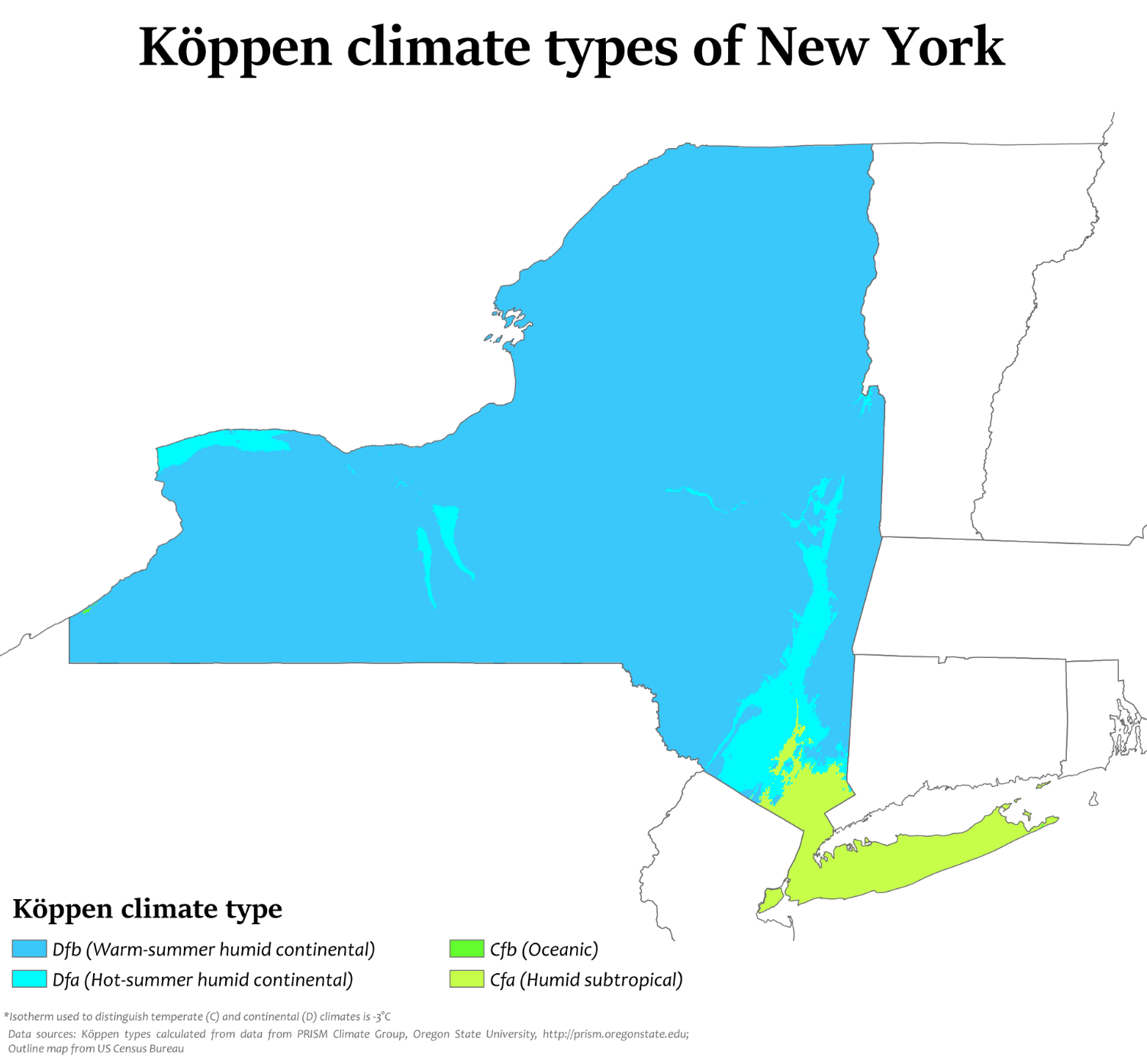
Topography and Climate
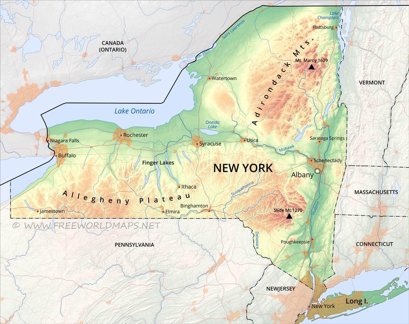
The topography of New York State includes lower-lying coastal areas of Long Island, New York City, and the Hudson Valley. The Hudson River Valley is bound by the Catskill Mountains to the west and Adirondack Mountains to the north. Stretching 149 miles between the Adirondacks, Catskills, and the Appalachian (Allegany) Plateau; the Mohwak River provides a relatively-narrow natural connection between regions facing the Atlantic Ocean and the central lowland regions facing the Great Lakes. These natural geographic and topographic features create a landscape that has structured and shaped human settlement patterns over time,


The Iroquois Confederacy, European Colonization, and American Settlement
The Iroquois (Haudenosaunee) are the historical inhabitants of the regions of the New York State beyond the Hudson River Valley and coastal areas. The Iroquois are often noted for the Iroquois Confederacy, a politically-collaborative form of government across multiple autonomous and distinct nations. Iroquois territory also stretched around Lake Ontario and up the St. Lawrence River.
The Iroquois were geographically separated and culturally distinct from the Algonquin-speaking populations that inhabited the coastal regions. The Adirondack and Catskill Mountains were natural geographic barriers between these two distinct peoples. As British and Dutch colonial settlements expanded up and down the Atlantic Coast, European colonial settlements in New York State were largely limited to the coastal areas and the Hudson Valley.
The influential Iroquois were allies of the British during the American Revolutionary War, and lost their territory with the establishment of the United States of America. Although the area beyond the Mohawk Valley was initially claimed by the newly-formed state of Massachusetts, New York State eventually won its claim to the Iroquois land. Within decades, the former Iroquois land was being settled by newly-arriving Europeans and Americans, a process that was accelerated by the construction of the Erie Canal. Expanded trade and eventual industrialization spurred the growth of New York State as a whole, and New York City became the dominant port on the East Coast of the United States.


Contemporary Geographic Patterns
Over the past two decades, the precision and sophistication of geospatial analysis has continued to improve. New analyses have sought to uncover underlying patterns in our economies, political systems, social interactions, and infrastructure development. These studies consistently show that the area of “Upstate New York” is a relatively self-contained economy. Multiple in-depth, high-quality studies show that money circulation, commuting and travel patterns, communication patterns, and even infrastructural connections continue to demonstrate that topography and geography continue to divide New York State in distinct and observable ways.


Popular Perspectives
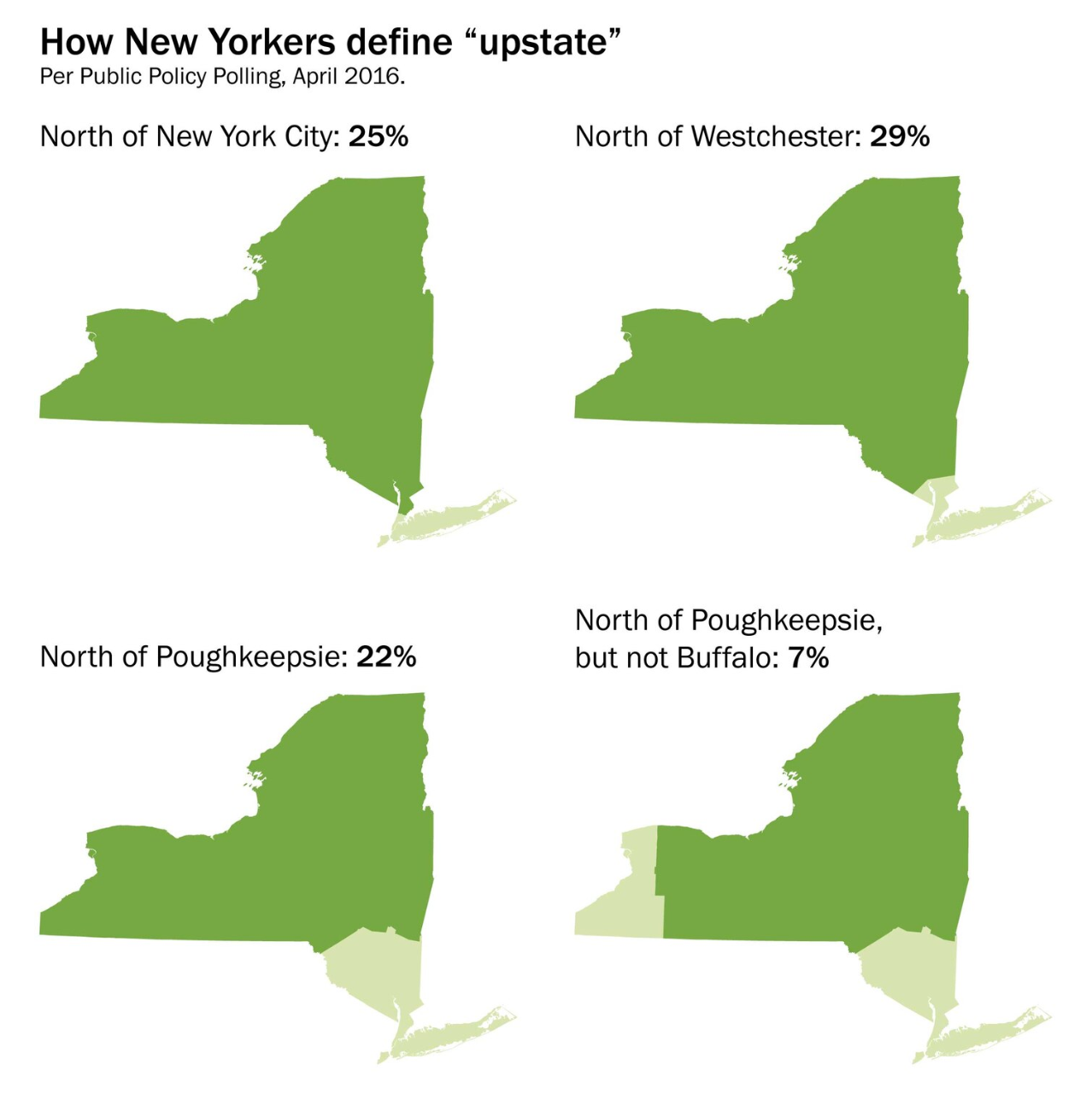
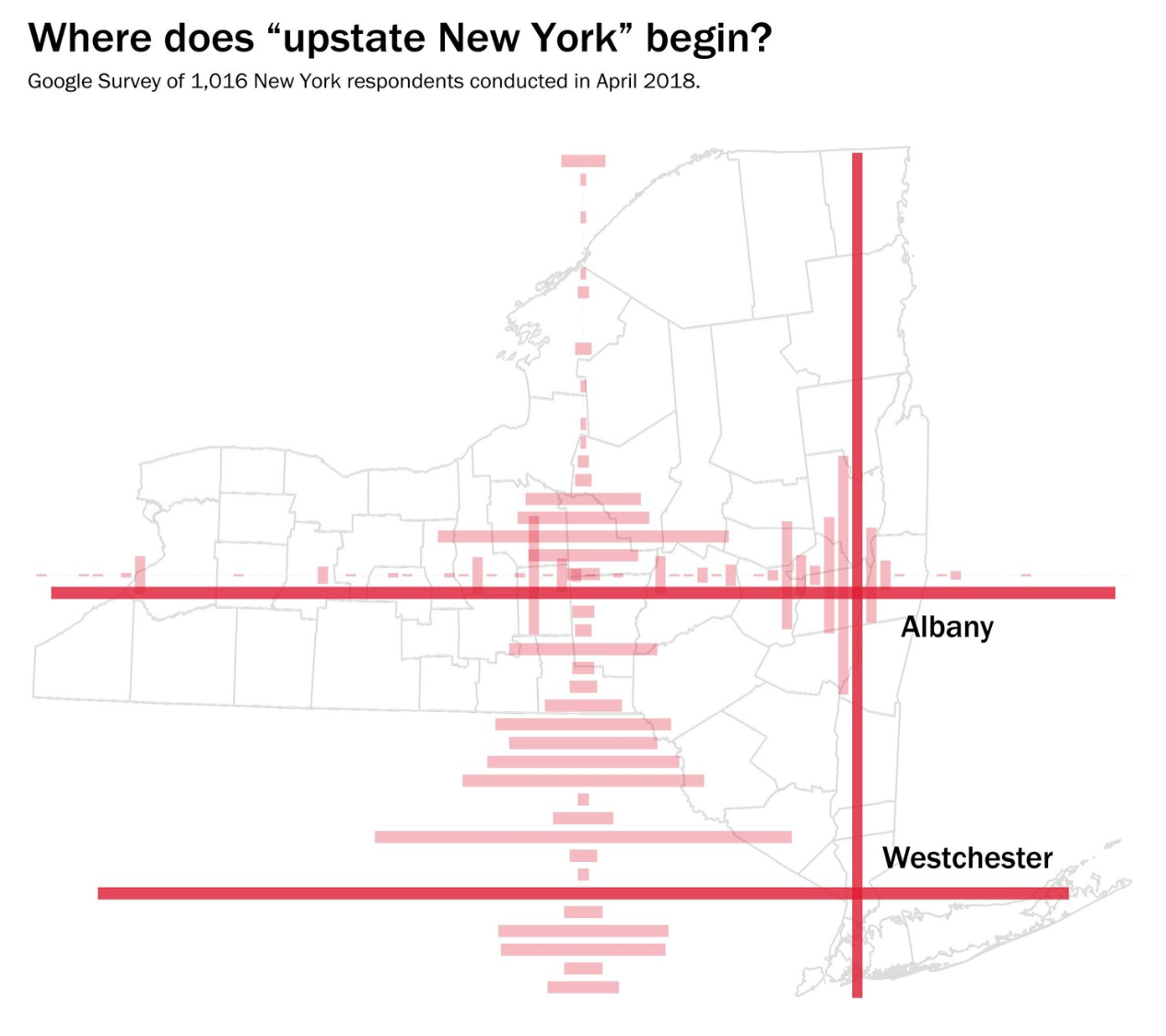
In 2016-2018, a series of polls were conducted by a Washington Post journalist, who was directly asking the question: “Where is Upstate New York?” The results of this analysis showed that 76% of respondents perceive the region to be north and west of New York City. The Catskill Mountains and Hudson River Valley tend to form natural boundaries for “Downstate New York,” according to the 2016 poll.
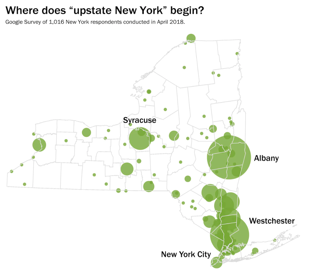
A follow-up poll in 2018 asked respondents to identify on a map where “Upstate New York” begins. The analysis shows two distinct starting points for this region, as distinct from “Downstate New York.” The first point is located in Westchester County, immediately north of the Bronx in New York City. The second point is located in Albany County. A review of both of these locations suggests that any areas north of Albany and west of the Hudson River Valley are considered by the public to be “Upstate New York.”
Do you have a map or a perspective to share?